








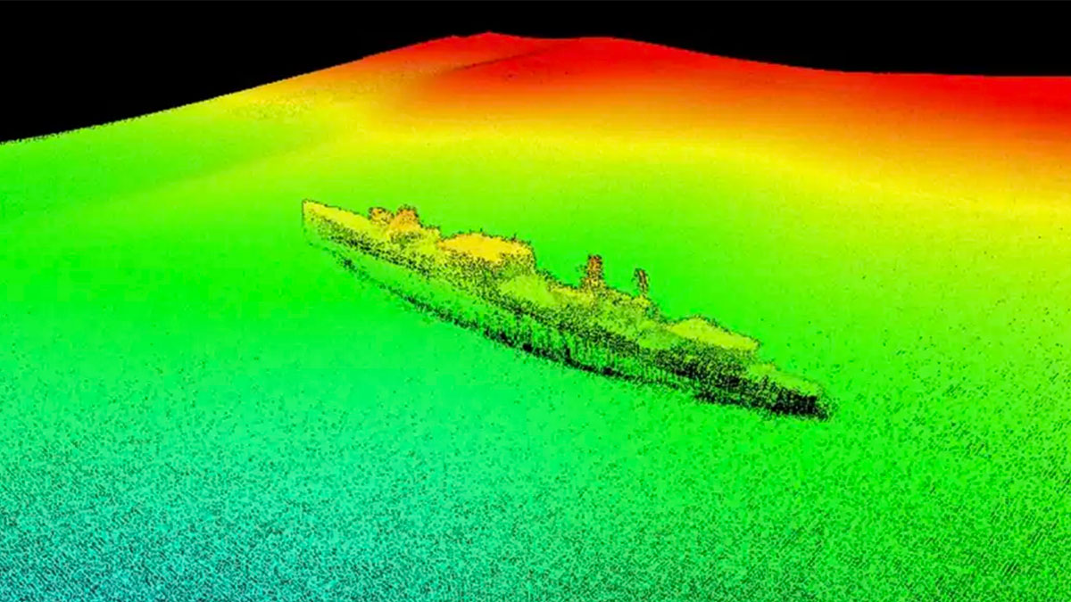
New technologies are revolutionizing underwater archaeological research. Three autonomous underwater vehicles—that is, underwater drones—from the company Ocean Infinity have located the wreck of the USS Stewart (DD-224) at a depth of 1,067 meters, within the Cordell Bank National Marine Sanctuary, about 80 kilometers from San Francisco, California.
The discovery, which took place in August 2024 but has only now come to light, puts an end to an 80-year-old mystery: What happened to one of World War II’s most enigmatic ships?Launched in 1920 as part of the Clemson class, the Stewart sustained severe combat damage in February 1942 near Java. An accident during repairs left it stranded in dry dock, and its own crew partially scuttled it in the face of the Japanese advance.
In an unexpected turn of events, the enemy salvaged the ship. The Japanese Navy refloated it, repaired it, and put it into service as a convoy escort under its own flag. Allied pilots reported, astonished, that they had seen what appeared to be their own destroyer operating in hostile territory: thus was born the nickname “Ghost Ship of the Pacific.”
Recovered after Japan’s surrender, the United States towed it back, as its engines had failed near Guam, and it was decided to intentionally sink it on May 24, 1946, during a naval firing exercise. Its exact location has remained a mystery ever since.
Workweeks reduced to hours
Today, we learned that Ocean Infinity’s three six-meter drones mapped 1,286 square miles of the ocean floor in just a few hours of intensive exploration—a task that would have taken several weeks using conventional methods. The nonprofit Air/Sea Heritage Foundation provided key historical coordinates of the tugboat involved in the sinking, and the maritime archaeology firm SEARCH, Inc. participated in the expedition alongside the U.S. Navy’s Naval History and Heritage Command.
From Warship to Steel Reef
The 3D images confirmed that the ship, which is 95 meters long, remains nearly intact and upright. Authorities at the sanctuary described it as an example of “exceptional” preservation for its age, potentially one of the best-documented “four-stack” destroyers of the U.S. Navy.
Throughout its 80 years at the bottom of the sea, the Stewart’s metal skeleton has functioned as an ecosystem in its own right, colonized by crabs and deep-sea fish. Beyond its historical value, this autonomous mapping technology has direct applications for identifying sites for offshore wind farms and mapping routes for undersea telecommunications cables.